

GPR sensors have been used in a variety of industries for many years, but their use is now becoming more widespread as the technology improves. Here we explain what GPR sensors are and how they can be used in your business.
GPR stands for ground-penetrating radar. A GPR sensor uses electromagnetic waves to penetrate the ground and create a three-dimensional image of the subsurface. This image can be used to detect buried objects, map the subsurface, and measure the depth of buried objects.
How do GPR Sensors Work?
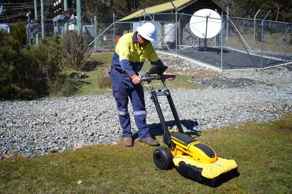
GPR (Ground Penetrating Radar) sensors are devices that emit electromagnetic waves into the ground and then measure the reflected signal. This reflection can be used to detect objects buried beneath the surface, as well as changes in the subsurface material. GPR can be used to detect a variety of things, including utilities, pipes, cables, and voids. It is a non-destructive technology that does not require any digging or excavation.
GPR works best on conductive materials, such as metals and wet soils. However, it can also be used on non-conductive materials, such as concrete and dry soil. The depth that GPR can penetrate depends on the frequency of the electromagnetic waves and the type of material being scanned.
GPR is a versatile tool that can be used for a variety of applications, such as locating utilities, mapping the subsurface, and detecting voids. It is a safe and non-destructive technology that does not require any digging or excavation.
How Long Have GPR Sensors Been Around?
GPR sensors have been around for many years. In fact, the technology has been used for decades to help locate underground utilities and other hidden objects. Today, GPR is commonly used in a variety of applications, including law enforcement, homeland security, construction, and environmental monitoring.
GPR sensors can be used for a variety of applications, including:
- Detecting buried utilities such as water pipes and cables
- Mapping the subsurface to locate groundwater resources
- Measuring the depth of buried objects
- Detecting voids and sinkholes
- Monitoring the stability of slopes and embankments
- Investigating the subsoil to assess its suitability for foundations
- Locating buried archaeological artifacts.
GPR sensors can be used in a variety of settings, including:
- On land
- In water
- On ice
- In the air
GPR data can be processed and interpreted by specially trained personnel to produce maps and three-dimensional images of the subsurface. This information can be used to make decisions about infrastructure development, environmental management, and archaeology.
If you think a GPR sensor could be useful for your business, contact a reputable supplier to discuss your requirements.